 |
PAGE 2
Grant's and Bill's
Maui Scrapbook
Haleakala Volcano
and
Iao Needle
|
PAGE 2 Grant's and Bill's Maui Scrapbook Haleakala Volcano and Iao Needle |
||
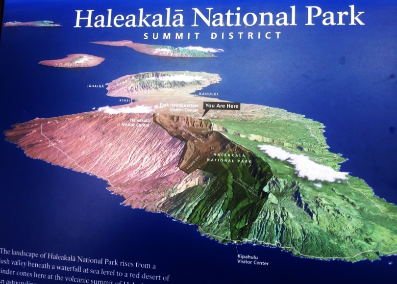
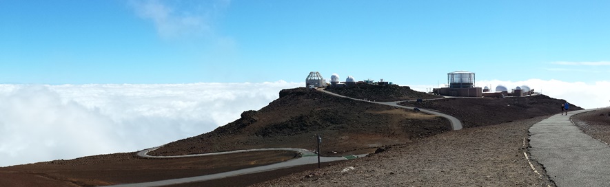
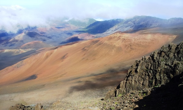
| v | Haleakala (hah-lay-AH-kah-lah) Haleakala ("House of the Sun") is the East Maui volcano that makes up 75% of the island. It is massive and just over 10,000 feet high. Haleakala has erupted three times in the last 900 years. It is considered an active volcano in a non-eruptive phase. |
 |
|
|||||
 |
|||||
|
|||||
 |
|||||
|
|||||
 |
|||||
|
|||||
 |
|||||
|
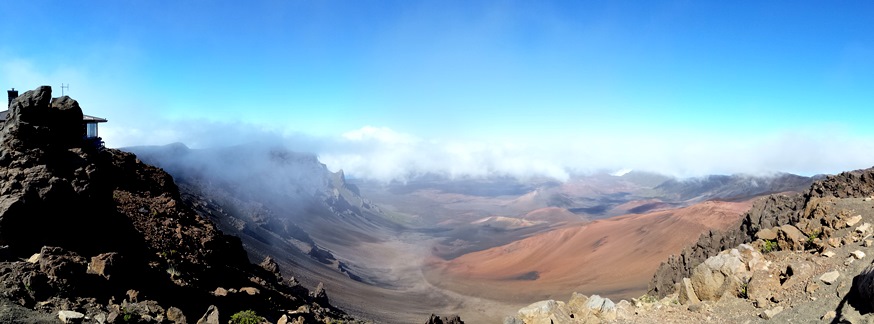
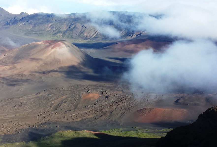
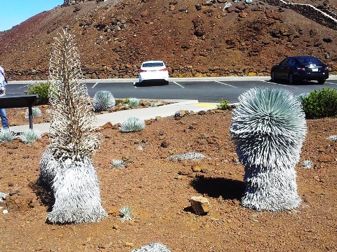
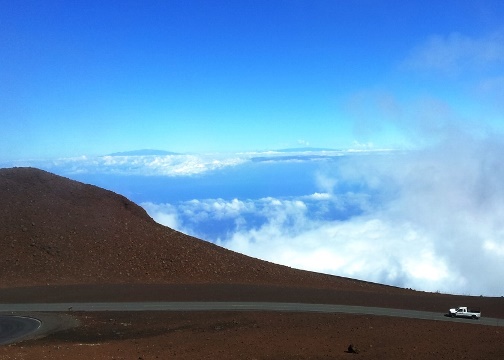
| As you probably noticed, there is little to no vegetation in the crater because volcanic cinder is almost devoid of nutrients. But there is a plant that thrives in this area, the Silversword. It lives only here on Haleakala and the nearby volcano, Mauna Kea, and only above 6,900 feet elevation. You would never guess, but this succulent plant is in the daisy family | Speaking of the nearby volcano, you can just make out the Big Island's two giant volcanoes in this photo. Look for the two darker blue areas just above the clouds. Mauna Kea is the one on the left and Mauna Loa is on the right, with the Kona Coast being the darker blue area below it. | |||
 |
 |
|||
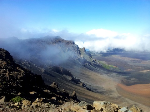
| Two almost adjacent views of the crater. This was such a spectacular view! | ||||
 |
 |
|||
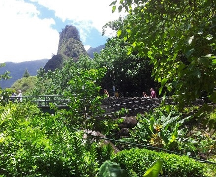
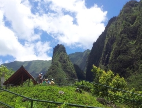
| v | Iao
Needle Maui is an island of huge contrasts in climate. Compare the dry and barren landscape of Haleakala with this area below. Iao Needle is part of the West Maui volcano complex. The western volcano is older than Haleakala and much more eroded. Its former height was 13,000 ft and is now eroded down to under 6,000 ft. It was a short but uphill hike to the viewpoint of Iao Needle. The photos show how close you can get to the needle, which is not close at all due to the rugged landscape and wet conditions. |
| The hike to the viewpoint of the Needle goes through dense, lush plantlife because this is a very wet section of the island. | It's pretty obvious from it's appearance why it is called a 'needle', but, surprisingly, it is actually a narrow ridge viewed end-on. It is a volcanic remnant. | |||
 |
 |
|||
| Go to PAGE 3 - Click
here Return to Page 1 |